

Key Takeaways
- Interstates prioritize speed and reliability; scenic routes prioritize experience and discovery.
- Scenic byways can add hours or even a full day to a trip — plan accordingly.
- Fuel and services are far more predictable on interstates than on rural scenic roads.
- A hybrid approach — mixing interstates for distance and byways for highlights — often works best.
- Your timeline, travel party, and vehicle all influence which road type makes sense.
Option A
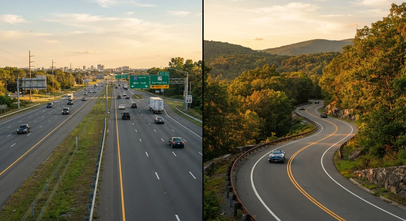
Interstate Highways
The fast, predictable backbone of American road travel.
Best for: Drivers who need to cover long distances quickly with reliable services, consistent road conditions, and minimal surprises.
Option B
Scenic Routes & Byways
The immersive, discovery-driven alternative to the fast lane.
Best for: Travelers who want the drive itself to be part of the experience — with landscapes, small towns, and memorable stops along the way.
If you're on a tight schedule with a hard arrival deadline
Interstate Highways
Interstates offer consistent speed limits, predictable traffic data, and reliable fuel stops — keeping your schedule on track with far less uncertainty.
If the journey itself is the destination
Scenic Routes & Byways
Scenic byways deliver the landscapes, local culture, and spontaneous stops that make a road trip genuinely memorable rather than just logistical.
If you're traveling with young children or elderly passengers
Interstate Highways
Frequent, well-equipped rest areas and easily accessible medical facilities make interstates more practical for passengers with frequent needs.
If you want to explore regional culture and local food
Scenic Routes & Byways
Small towns along designated byways often feature local diners, roadside history, and regional character that interstates simply bypass.
If you're looking to blend efficiency with adventure
Interstate Highways
Use interstates to cover the bulk of your miles efficiently, then peel off onto a scenic byway for key segments — getting the best of both approaches.
What Actually Separates These Two Road Types
Interstate highways are federally designed, controlled-access roads built for sustained high-speed travel across states. They're standardized — expect consistent lane widths, grade limits, and service infrastructure roughly every 50 miles. Scenic routes, many of which are officially designated as National Scenic Byways or All-American Roads by the Federal Highway Administration, are chosen precisely because of their intrinsic qualities: natural beauty, cultural heritage, historic character, or recreational value.
The practical gap between them is significant. On an interstate, 400 miles might take around 6 hours at legal speeds. The same stretch on a winding two-lane byway could stretch to 9 or 10 hours — and that's before factoring in stops. That difference isn't a flaw; it's the point. But it has to be planned for.
| Criterion | Interstate Highways | Scenic Routes & Byways |
|---|---|---|
| Average speed | 65–75 mph (posted limits) | 35–55 mph, with stops |
| Fuel stop frequency | Every 20–50 miles typically | Can exceed 50–80 miles between stations |
| Scenery & experience | Functional; limited visual interest | High; landscapes, towns, landmarks |
| Road condition predictability | Very consistent | Variable; some routes poorly maintained |
| Emergency services access | Frequent and well-marked | Limited in remote areas |
| Trip time impact | Minimal added time | Can add 25–50% more travel time |
| Local culture exposure | Very low | High — small towns, regional food |
The Real Costs: Time, Fuel, and Comfort
Time is the most obvious trade-off, but fuel efficiency deserves attention too. Steady highway speeds — typically 60–70 mph — generally keep engines in their most efficient range. Stop-and-go driving through mountain passes or small towns on scenic routes can reduce fuel economy noticeably, depending on your vehicle. If you're already working to manage expenses, the fuel and lodging strategies in our budget road trip guide become especially relevant on byways where options thin out.
Comfort also shifts. Interstates offer frequent chain rest stops, predictable food options, and easy access to emergency services. Scenic routes can mean long gaps between gas stations — sometimes 40–60 miles in remote areas — and limited lodging choices. That's an adventure for some travelers and a genuine stressor for others.
150,000+
Miles of US scenic byways designated nationally
The Federal Highway Administration's America's Byways program has designated over 150 routes across the country as National Scenic Byways or All-American Roads.
47,000+
Miles in the US Interstate Highway System
According to the Federal Highway Administration, the Interstate Highway System spans over 47,000 miles, connecting all major US metro areas.
25–50%
Extra travel time scenic routes can add
Depending on terrain and stops, scenic byways often add a quarter to half of additional drive time compared to an equivalent interstate route.
When Each Option Makes the Most Sense
Choosing intelligently means being honest about your trip's priorities. Ask yourself three questions: How firm is my arrival deadline? Who's riding with me? And what do I want to remember about this trip?
Interstates make clear sense when you're covering serious mileage under time pressure, traveling with passengers who need frequent accessible stops, or driving unfamiliar terrain at night. They're also the safer default when weather is uncertain — emergency infrastructure is simply more accessible.
Scenic routes shine when your schedule has a buffer of at least a day, you have a vehicle in solid mechanical condition, and your travel party is genuinely up for the unexpected. The anatomy of a well-planned US road trip is a useful starting point for building that kind of flexibility into your itinerary from the start.
Check Road Conditions Before You Go
Scenic routes — especially those through mountain passes, desert stretches, or coastal cliffs — can be affected by seasonal closures, weather events, or maintenance work. Before committing to a byway, verify current road status through your state's Department of Transportation website or the official America's Byways resource. Some routes are simply not passable in winter or after heavy rainfall, and that's not information you want to discover mid-drive.
The Hybrid Approach: Taking Both Roads
Most experienced road trippers don't choose one type over the other — they combine them strategically. A common approach: use interstates to cover the distance-heavy legs of your trip, then deliberately exit onto a scenic byway for segments that pass through high-interest areas. Many state tourism offices publish official byway maps that make it easy to identify which detours are worth the extra time.
Navigation matters here. When you're mixing route types, real-time updates and offline backup maps are genuinely useful — something our road trip navigation guide covers in depth. If you're new to planning this kind of trip, our first-timer's road trip planning guide walks through how to structure a flexible, hybrid itinerary without overcomplicating it.
The bottom line: the interstate gets you there; the scenic route makes the getting-there worth telling people about. The smartest trips usually find room for both.